

Verify existing aerial data
before a decision rests on it.
We set independent surveyed checkpoints, compare the data to those checkpoints, and return a written result with the stated ASPRS class, checkpoint count, and measured RMSE.
The data may be ours, another vendor's, or your own UAS program's. The verification describes what the checkpoints show, including where the dataset does not support its stated class.
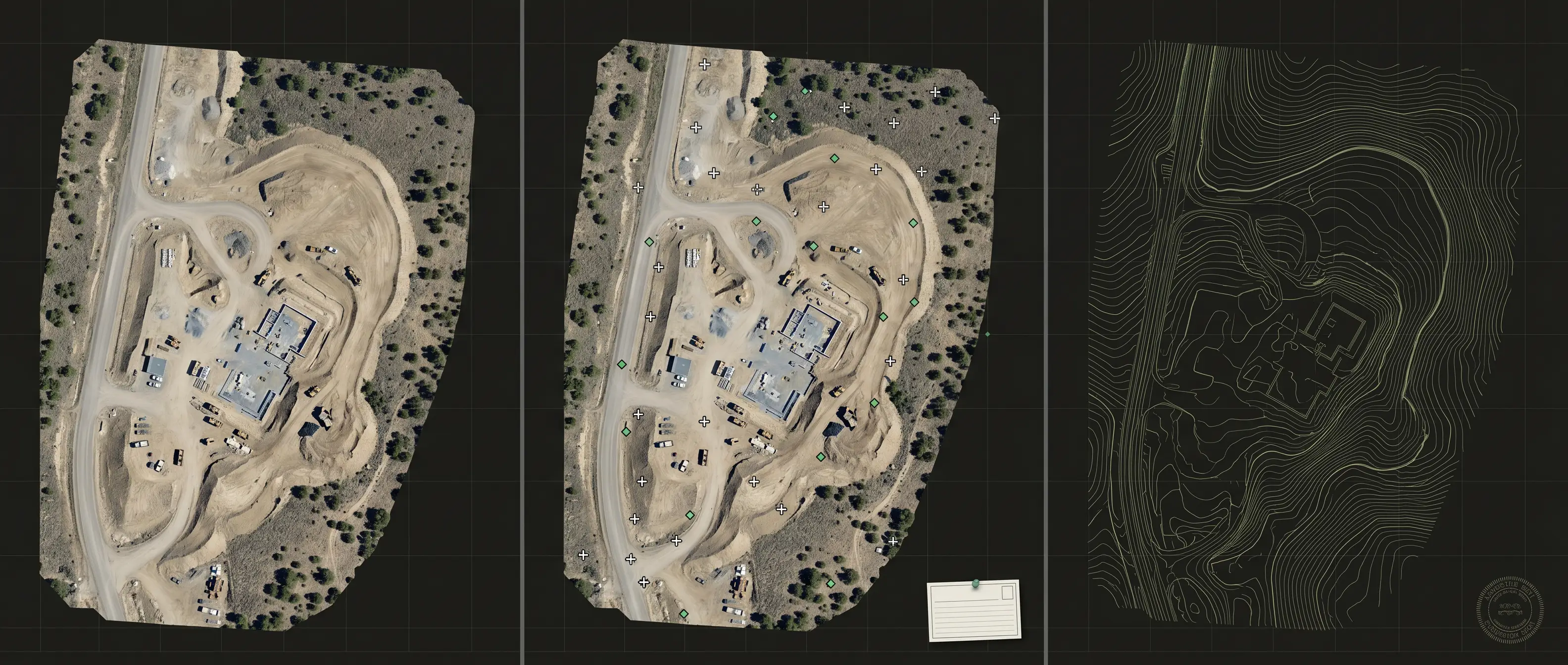
Three facts replace a general accuracy claim.
A useful verification names the class being evaluated, the evidence behind the statement, and the measured error.
Two common reasons to order an independent check.
Verification is most valuable before the dataset enters a higher-consequence decision or while an internal program is improving its own process.
Confirm the evidence before relying on the handoff.
A property acquisition, project transition, or vendor deliverable can arrive with a broad claim and little supporting detail. Independent checkpoints show whether the data supports the class it names.
Use the result as a neutral read on your workflow.
An in-house program can verify its own output independently. The location and pattern of residuals can point toward control, capture, processing, or documentation practices that deserve review.
How the verification is performed.
The scope begins with the dataset, its stated coordinate reference system, the accuracy class it claims, the area that matters, and the decision the client intends to make. Checkpoint locations are planned independently of the data producer's control.
The checkpoints are surveyed in the field and compared with the supplied surface or image product. The resulting residuals are used to compute and document RMSE. The report identifies the tested area, data version, checkpoint count, and any limitations that affect interpretation.
What you receive.
How to use the result.
A passing result supports the specific tested class, area, and data version in the report. It should not be extended to a different capture, a changed surface, or an untested portion of a broader site.
A failing result is still useful. The residual pattern and field notes help isolate whether the next action is additional control, a processing correction, a partial re-flight, or a new capture.
The verification is priced to the site and checkpoint count before mobilization. We do not publish blanket accuracy numbers because the result belongs to the dataset tested.
Professional roles remain distinct.
Outlook UAS can collect checkpoints and prepare a verification report within the agreed scope. Where offered, recordable or stamped survey deliverables are scoped and coordinated with a licensed Professional Land Surveyor. A verification report does not substitute for a PLS stamp where law, contract, or permitting requires one.
Know what you are standing on.
One site visit, independent checkpoints, and a written answer. If the data supports the intended class, you proceed with measured evidence. If it does not, you discover that before the next decision.
Bring the dataset and the decision it needs to support.
We will identify the required area, checkpoint approach, report mode, and any professional-survey boundary before quoting the field work.