

Check completeness before the crew leaves.

Our processing workstation, ground-control equipment, and power travel with the capture crew. The first useful check happens on site, while a recoverable gap can still be flown again.
Scope a Field Workflow → Read the field note
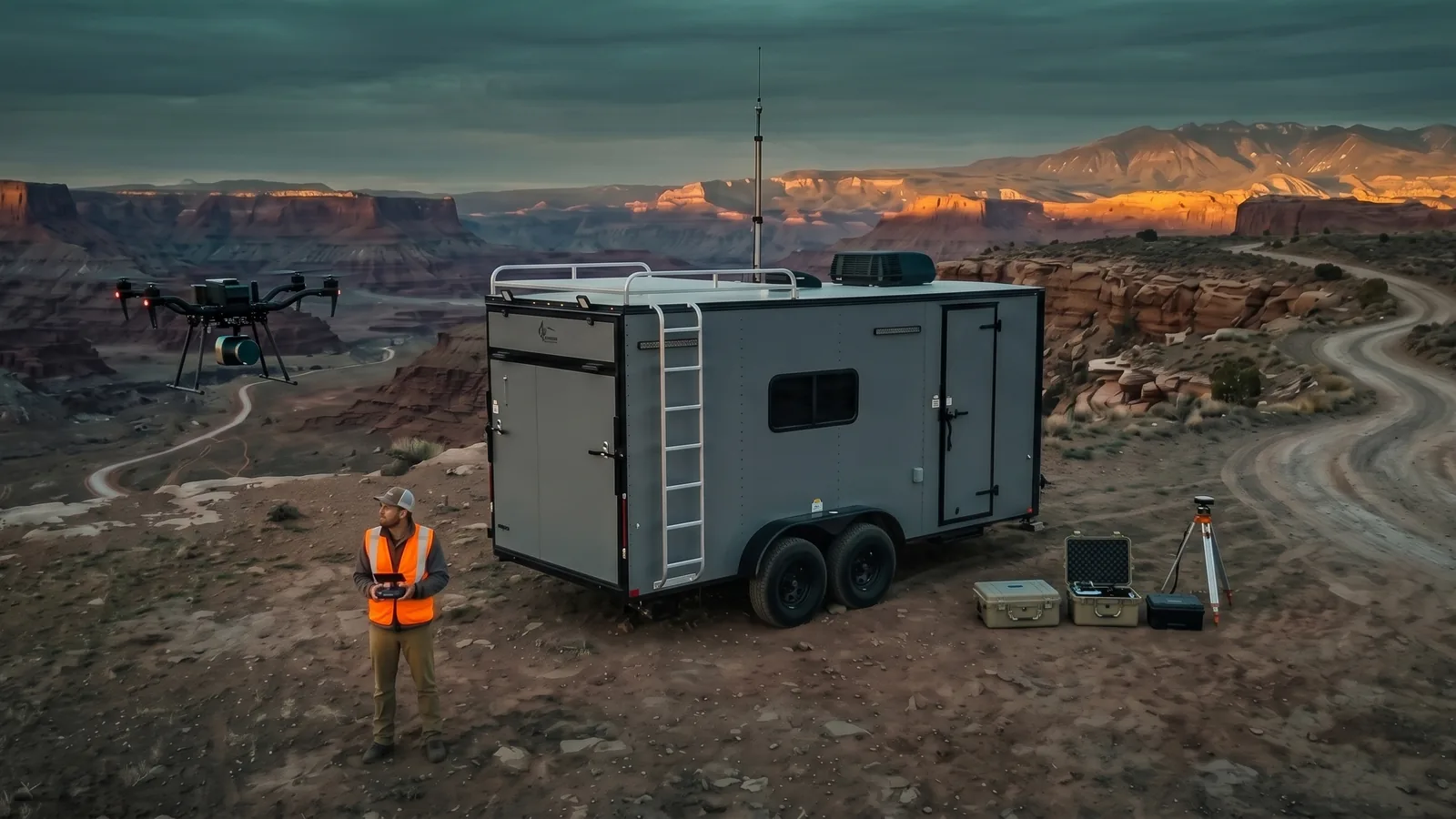
Mobile field-processing trailer parked on a canyon rim at dusk, with a pilot flying a mapping drone and ground-control equipment staged beside the trailer
One mobilizationRecoverable gaps can be addressed while the crew remains on site.
Local processingThe first alignment and product are not waiting in an office queue.
Scope-dependent deliveryEligible standard-scope projects are typically delivered within 24 hours of capture.

Capture, process, check, recover, deliver.

The workflow separates what happens on site from what the final report can claim. Completeness checks reduce remobilization risk; independent checkpoints supply tested accuracy when the scope requires it.

1. Capture the planned site
The mission is planned around the boundary, terrain, airspace, obstructions, sensor, intended product, and required accuracy mode. PPK and ground-control work are set according to the scope.
2. Process a first result on site
Imagery is transferred to the on-site workstation, aligned, and used to build the first product needed for quality control: an operational checkpoint, not the final delivery package.
3. Check completeness and control
The crew reviews the planned extent, visible gaps, overlap, alignment, and control residuals. Where the project is scoped as tested to ASPRS, independent checkpoints are evaluated and the measured result is documented.
4. Re-fly recoverable gaps
If coverage is short, overlap is inadequate, or a local area needs another pass, the crew can plan a targeted recovery while site access and equipment are still available. Weather, airspace, safety, or a changed scope may still require a later plan.
5. Prepare and deliver the package
Final outputs, the methodology record, accuracy statement, and file formats are prepared for the client portal. Eligible standard-scope projects are typically delivered within 24 hours of capture; larger or survey-tested scopes receive a stated timeline.
The mobile processing unit

A field lab that travels with the mission.

The field and processing team share the same context.

Instead of sending raw imagery to a third-party queue, the crew that observed the site also sees the first alignment and completeness result. That shortens the feedback loop without changing the accuracy evidence required by the final use. Our 10′ × 20′ mobile command-center trailer keeps capture, initial processing, ground control, and field decisions in one operating location.

Mission equipment
Aircraft, sensors, batteries, and operating records organized for the stated site and product.
GNSS and control
PPK and ground-control equipment used according to the agreed accuracy mode.
Processing workstation
Local compute for transfer, alignment, first-product generation, and field quality control.
Independent power
A self-contained work environment for remote pads, quarries, corridors, and sites far from an office.

Built for the far side of the map.

Because the lab travels with us, we reach sites a fly-in, drive-out crew can't justify: high country, working ranches, and infrastructure miles from the nearest office.
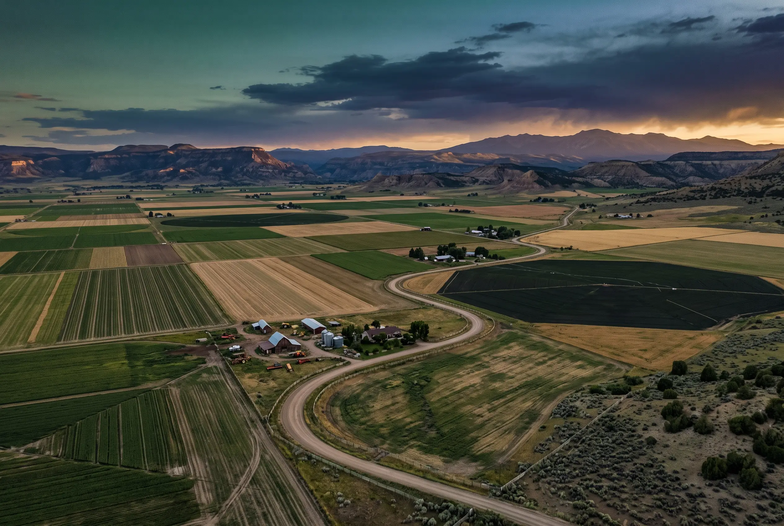
Aerial view of agricultural fields and rangeland at dusk
Agriculture & rangeland

High-resolution RGB over working fields, processed before we roll off the property.

Faster feedback, with the limits stated.

Field processing addresses operational delay and incomplete capture. It does not replace a project-specific accuracy plan or safe operating judgment.

Remote access becomes more practical
High-country, rangeland, mining, energy, and linear-infrastructure sites benefit when the crew can complete the first check during the planned mobilization.
Schedule risk becomes visible earlier
A gap found on site can be weighed against weather, daylight, airspace, active equipment, and site rules before the team demobilizes.
The final claim remains evidence-based
Produced-to and tested-to ASPRS workflows remain distinct. Where offered, survey-quality, stamped, or recordable work is coordinated with a licensed PLS holding responsible charge.

The whole lab rolls in with us.
No data point gets left behind.

We will scope the boundary, operating window, field checks, recovery conditions, accuracy mode, and realistic delivery timeline before the crew rolls.

Get a Free Quote → View Past Work